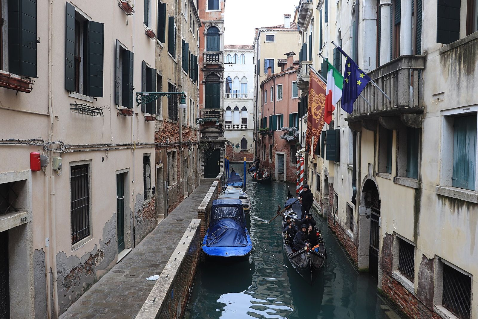
Venice has somewhere between 150 and 177 canals, depending on whether every short stretch and dead end is counted. Most are narrow, many are only a few metres wide, and together they divide the city into the more than a hundred islands it is built on.
Canale, rio and rio terà
Venetians are precise about water. Only a handful of the largest waterways are called canale: the Grand Canal, the Giudecca Canal, the Cannaregio Canal and a few channels out in the lagoon. Almost everything else is a rio, plural rii, and the very smallest are sometimes called rielo. The word rio does not mean a river here. It simply means a canal running between buildings.
A street called rio terà, a filled-in rio, tells you that there used to be water underfoot. Venice lost a good many canals this way, above all in the 19th century, when about 6 km of rii in 44 separate stretches were filled to make wider routes on foot. The broadest of them, Via Garibaldi in Castello, was created in 1807 under Napoleonic rule; the Rio Terà San Leonardo, on the main walk from the station to the Rialto, is another. The process has occasionally been reversed: the last stretch of the Rio della Crea in Cannaregio, filled in 1837, was dug out again in the 1990s.
Other words on the white street signs, the nizioleti, follow the same logic: a fondamenta is a paved quay along a rio, a sotoportego a passage under a building. The glossary has the full list.
The main waterways
The Giudecca Canal
The widest channel inside the city separates the long island of the Giudecca from the Zattere, the sunny quay along the southern edge of Dorsoduro. It is deep enough for large ships, and for decades cruise liners passed through it on their way to the port; since 2021 the largest have been barred from it and from the basin of St Mark’s. On the third weekend of July a pontoon bridge spans it for the Redentore festival (see Giudecca & San Giorgio).
The Cannaregio Canal
The second-largest canal in the historic city runs for nearly 800 m from the Grand Canal, beside the church of San Geremia, to the northern lagoon at San Giobbe. It is 22 to 27 m wide and was long one of the main water routes between the city and the mainland. Two bridges cross it. The Ponte delle Guglie, near the Grand Canal end, was rebuilt in stone in 1580 and took its name from the pinnacles added in 1823. The Ponte dei Tre Archi, near the lagoon, was rebuilt in 1688 by Andrea Tirali and is the only three-arched bridge left in Venice.
Rio Novo
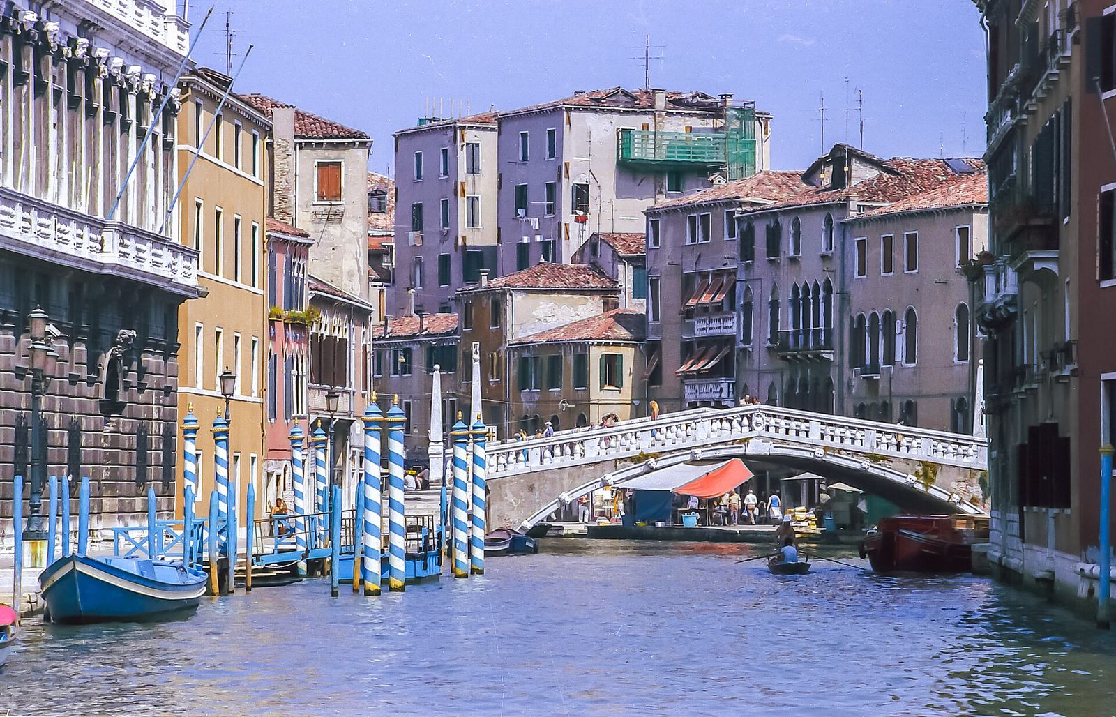
Not every canal is old. The Rio Novo was cut in the early 1930s, to a design by the city engineer Eugenio Miozzi, as a short cut from the new road terminal at Piazzale Roma to the Grand Canal near Ca’ Foscari. Public water buses once used it but were later withdrawn, largely because their wash was damaging the banks and the buildings along it. Taxis and service boats still pass through.
Rio di Palazzo
This short, deep rio runs between the Doge’s Palace and the prisons and opens onto the waterfront at the Ponte della Paglia. Its fame comes from the enclosed white bridge that crosses it high above the water, the Bridge of Sighs, described in the bridges chapter.
The parallel canals of Cannaregio
From the Ghetto northwards, three long canals run side by side from west to east: the Rio della Madonna dell’Orto, the Rio della Sensa and, furthest south, the canal known as Rio degli Ormesini in its western stretch and Rio della Misericordia further east. Their straight lines are the trace of medieval land reclamation, when marshes on the city’s northern edge were drained to a regular plan. Their wide quays, built for loading and unloading, make some of the easiest walking in Venice.
Canale di San Marco and the Bacino
The Grand Canal and the Giudecca Canal meet in the Bacino di San Marco, the basin in front of the Doge’s Palace. From there the deep Canale di San Marco leads past the Riva degli Schiavoni towards the Lido: the busiest water in the city.
Six sestieri shaped by water
The historic city is divided into six districts, the sestieri: Cannaregio, Castello and San Marco on the left bank of the Grand Canal, Santa Croce, San Polo and Dorsoduro on the right. Each has a character that owes a lot to its water. Cannaregio, usually described as the most populous, has the long parallel canals of its northern half. Castello, the largest, wraps around the walled basins of the Arsenale, the Republic’s shipyard. San Marco, inside the last loop of the Grand Canal, is the old political centre.
On the other bank, Santa Croce holds Piazzale Roma, the one place where cars and buses reach the historic city. San Polo, the smallest, grew up around the Rialto market. Dorsoduro, whose name means hard back, is usually said to stand on firmer ground. Houses are numbered through each sestiere rather than street by street, which is why an address can run to four digits and still not tell you which rio it stands on.
What holds the city up
Every building beside a rio rests on wood. Builders drove closely spaced piles, traditionally of alder as well as oak and larch, down through the soft mud to a firmer layer of compacted clay that Venetians call caranto. Kept wet and away from the air, the timber decays extremely slowly, which is why piles driven centuries ago still carry their walls.
On top of the piles went a platform of planks and then, at the waterline, several courses of Istrian stone, a dense white limestone shipped across the Adriatic from Istria. It resists salt water and stops damp rising into the brick above. Look along any rio at low tide and you can see this pale band running along the base of the walls, often with a green fringe of weed just below it.
Tides, silt and waves
Every rio is tidal. Twice a day the lagoon rises and falls through the city, and the difference shows: at low tide the steps of the water gates are exposed and slippery, and some narrow rii become too shallow for loaded boats; at high tide boats with tall cabins can no longer pass under the lowest bridges. For centuries the tide also flushed the canals clean, doing much of the work of a drainage system.
Silt settles all the same, and dredging the rii has been routine since the days of the Republic. Today a stretch of canal is either dredged with the water still in it or sealed off with steel sheet piles and pumped dry, so that the mud can be removed and the banks and foundations repaired. The work is done quickly, because emptying a canal for too long can disturb the ground beneath the neighbouring houses. A city programme launched in the late 1990s set out to work through around 50 km of rii in this way.
The greatest modern threat is moto ondoso, the wash from motorboats. Every wave slaps against walls that were built for oars and slowly sucks the mortar out from between the stones. Speed limits apply throughout the city, lowest in the narrow rii. Water-level changes during exceptional tides are covered in the tides chapter.
Walking the fondamenta
Not every canal has a pavement. Many rii run between blank house walls, reachable only by boat, and a walk in Venice is a constant negotiation between fondamenta, bridges and dead ends that stop at the water. Where a fondamenta does exist, it is the pleasantest way to see a canal at work: barges unloading, residents mooring their boats at the striped poles, a delivery boat squeezing under a bridge with centimetres to spare.
A canal-side walk
Two easy walks, largely on wide quays. Times allow for an unhurried pace.
Route card
Ponte delle GuglietoFondamenta della Misericordia
Tip
Follow the Cannaregio Canal to the Tre Archi, turn back through the Ghetto and end on the Ormesini and Misericordia quays in the late afternoon.
Route card
ZatteretoPonte dei Pugni
Tip
The Zattere faces south, so it stays sunny in winter. Turn inland along the Rio di San Trovaso, past the old gondola boatyard, to reach Campo San Barnaba.
Both walks are on public quays. Quays near the Grand Canal can flood at high tide; check the tide forecast in the colder months.
Questions
Why do so many canals have no pavement beside them?
Because the houses were built to be reached by boat. Their main entrance was the water gate, and the street door at the back was secondary. Quays were added where trade needed them, not everywhere.
Are the canals ever drained?
Yes, in sections. For maintenance a stretch of rio is closed off and pumped dry for a short time so that the mud can be removed and the walls repaired. If you come across one, you can see the foundations that normally stay under water.
Can you swim or paddle in the canals?
Swimming is forbidden: the canals carry heavy traffic and the water is not fit for bathing. Rules for small craft are strict; check the City of Venice’s official information first.