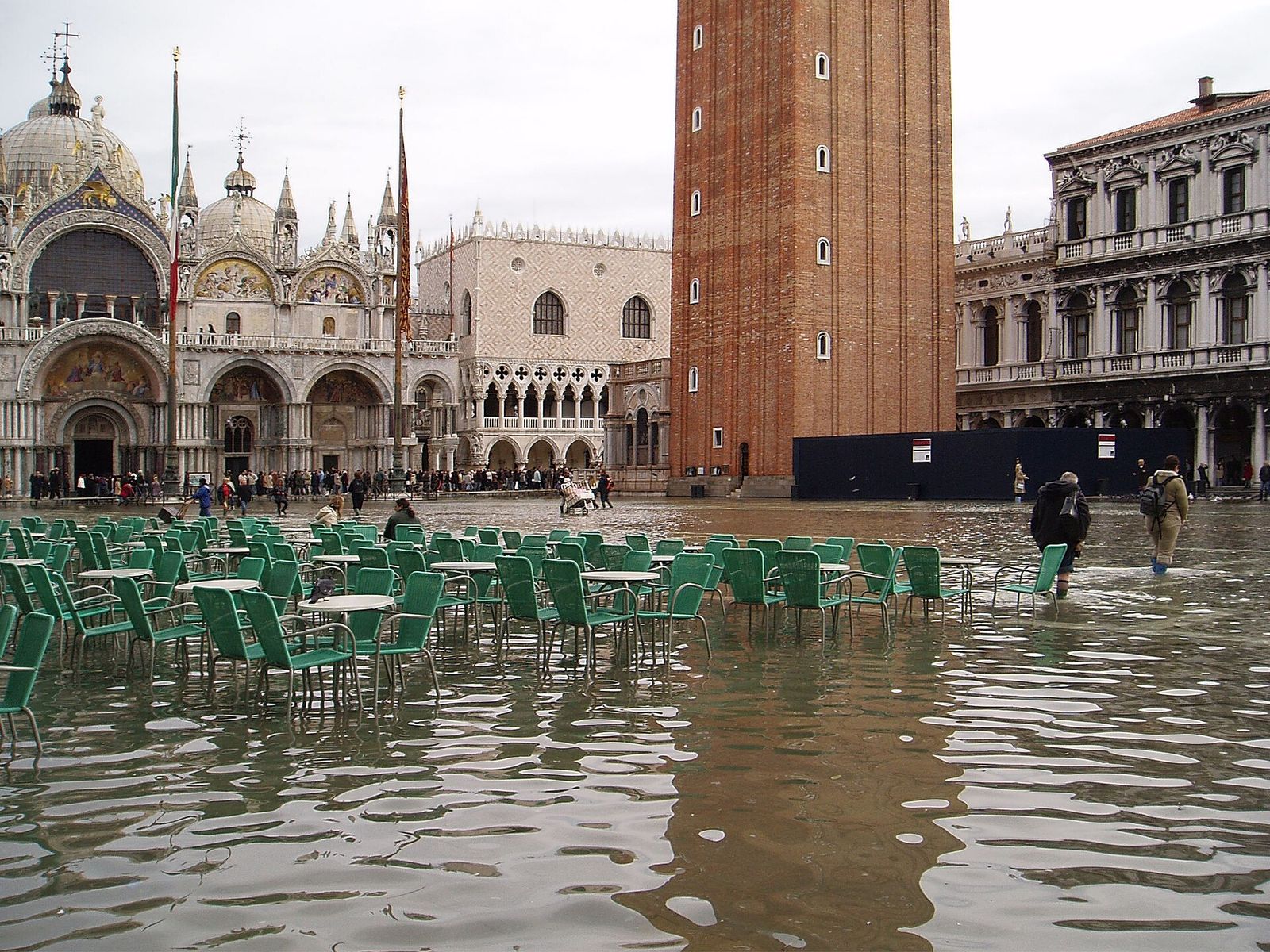
Venice measures its tides in centimetres above a reference level fixed in 1897 at Punta della Salute, the tip of land beside the Salute church. When residents say the tide will reach “a hundred and ten”, that is the scale they mean.
Two tides a day
The lagoon breathes through its three inlets. For about six hours the sea pushes in through the Lido, Malamocco and Chioggia inlets, filling the channels and creeping over the mudflats; for the next six it drains out again. The rhythm of two high and two low tides in a little over a day is set by the moon and the sun, and it can be predicted years in advance.
In ordinary conditions the difference between high and low water is modest, usually well under a metre and a little more around new and full moon. It is still enough to change the look of the city: at low tide a green band of weed shows on the brickwork and moored boats sink below the edge of the quay.
Very low tides, most common on calm winter days of high pressure, can leave the smaller rii almost dry, stranding boats in the mud until the water comes back. The basin the tides move through is described in the chapter on the lagoon and its rivers.
What acqua alta means
Acqua alta, “high water”, is the name for a tide that rises far enough to flood the lowest parts of the city. The pavements of Venice are not all at the same height, so the same tide can leave one campo dry and put another under ankle-deep water. The lowest place of all is St Mark’s Square: water starts to spread across it at around 80–90 cm, and the porch of the basilica lies lower still. Often the first water does not come over the quay at all but bubbles up through the drain gratings in the paving, because the drains run out into the canals.
The city’s tide centre sorts high tides into three bands.
| Level | Official description | What it means on the ground |
|---|---|---|
| 80–109 cm | Sustained tide (marea sostenuta) | Water in St Mark’s Square and a few of the lowest areas |
| 110–139 cm | Very sustained tide (marea molto sostenuta) | About 14 % of the city flooded at 110 cm, over 40 % at 130 cm |
| 140 cm and above | Exceptional tide (marea eccezionale) | More than half of the city under water |
Exceptional tides are rare, but tides above 110 cm have become noticeably more frequent over recent decades, partly because the city now stands lower in relation to the sea than it did a century ago. Most come between October and January.
Why the water rises
Acqua alta never has a single cause. It happens when several forces push in the same direction at the same time.
The astronomical tide
The regular tide set by the moon and the sun is the base on which everything else stacks. Around new and full moon, and particularly near the equinoxes, it runs higher than usual. On its own it seldom floods more than the lowest spots.
Sirocco and bora
The Adriatic is a long, narrow sea, and Venice lies at its closed northern end. When the sirocco blows from the south-east along its whole length, it piles water against the northern shore and holds back the ebb, so each high tide starts from a higher level than the one before. The bora, a cold north-easterly, blows more directly onto the coast and drives water through the inlets and across the lagoon.
Low pressure
Air presses down on the sea. When a deep depression crosses the northern Adriatic, the surface rises by roughly a centimetre for every hectopascal the pressure falls, so a strong low can add a few tens of centimetres by itself.
Seiches
After a storm the Adriatic keeps rocking from end to end, like water in a bath. This slow swing, called a seiche, has a period of about 21–22 hours and can bring a second rise a day after the wind has dropped, catching people out when the weather already looks better.
Forecasters combine all of these factors, which is why a precise forecast is possible a day or two ahead but only a rough one further out.
Records and the long trend
- 4 November 1966
- about 194 cm
- 12 November 2019
- about 187 cm
- Lost against the sea since 1897
- about 23 cm
On 4 November 1966 a sirocco gale, heavy rain and a deep depression arrived together. The tide reached about 194 cm, the sea broke through the Murazzi sea walls at Pellestrina, and the water did not fall back for the best part of a day. The flood, which struck on the same day as the Arno flood in Florence, set off the international campaigns to safeguard Venice.
On 12 November 2019 the tide reached about 187 cm, pushed by a sudden and violent local wind on top of an already high tide. Water entered St Mark’s Basilica, boats were thrown onto the quays and parts of Pellestrina flooded.
Behind the records lies a slower change. According to the city’s tide centre, Venice has lost about 23 cm of height relative to the sea since 1897. Roughly half of that is natural, the slow settling of the ground and the rise of the sea; the rest came mainly from pumping groundwater for industry on the mainland in the twentieth century, which was stopped in the 1970s. Sea levels are still rising, so tides that once counted as exceptional are expected to become more common.
Sirens, forecasts and walkways
The City of Venice runs a tide forecasting and warning centre, the Centro Previsioni e Segnalazioni Maree, which publishes forecasts and live readings from gauges around the lagoon. Forecasts are also shown on displays at many water-bus stops. When a tide of about 110 cm or more is expected, sirens sound across the historic centre and the islands a few hours before the peak.
The signal comes in two parts. First a siren sounds to catch your attention; then a sequence of notes tells you how high the water is expected to rise:
- one long, steady note: around 110 cm
- two rising notes: around 120 cm
- three rising notes: around 130 cm
- four rising notes: 140 cm or more, an exceptional tide
On the busiest pedestrian routes, raised walkways called passerelle go up when high water is expected: narrow platforms of planks on metal trestles, with a walking surface at roughly 120 cm on the tide scale. Around St Mark’s they are often the only dry way across.
MOSE: gates at the inlets
Since 2020 the worst tides can be held back before they reach the city. MOSE, short for Modulo Sperimentale Elettromeccanico and a nod to Moses parting the sea, is a set of 78 hinged steel gates laid in four rows across the three inlets: two rows at the Lido inlet, separated by an artificial island, one at Malamocco and one at Chioggia.
Most of the time the gates cannot be seen. Each one is a hollow box lying flat in a concrete housing on the seabed, filled with water. When a dangerous tide is forecast, compressed air is pumped in and the water forced out, and the gates swing up on their hinges until they break the surface and form a wall between sea and lagoon. Raising takes about half an hour. When the tide has passed, water is let back in and the gates sink into their housings again. A closure usually lasts a few hours.
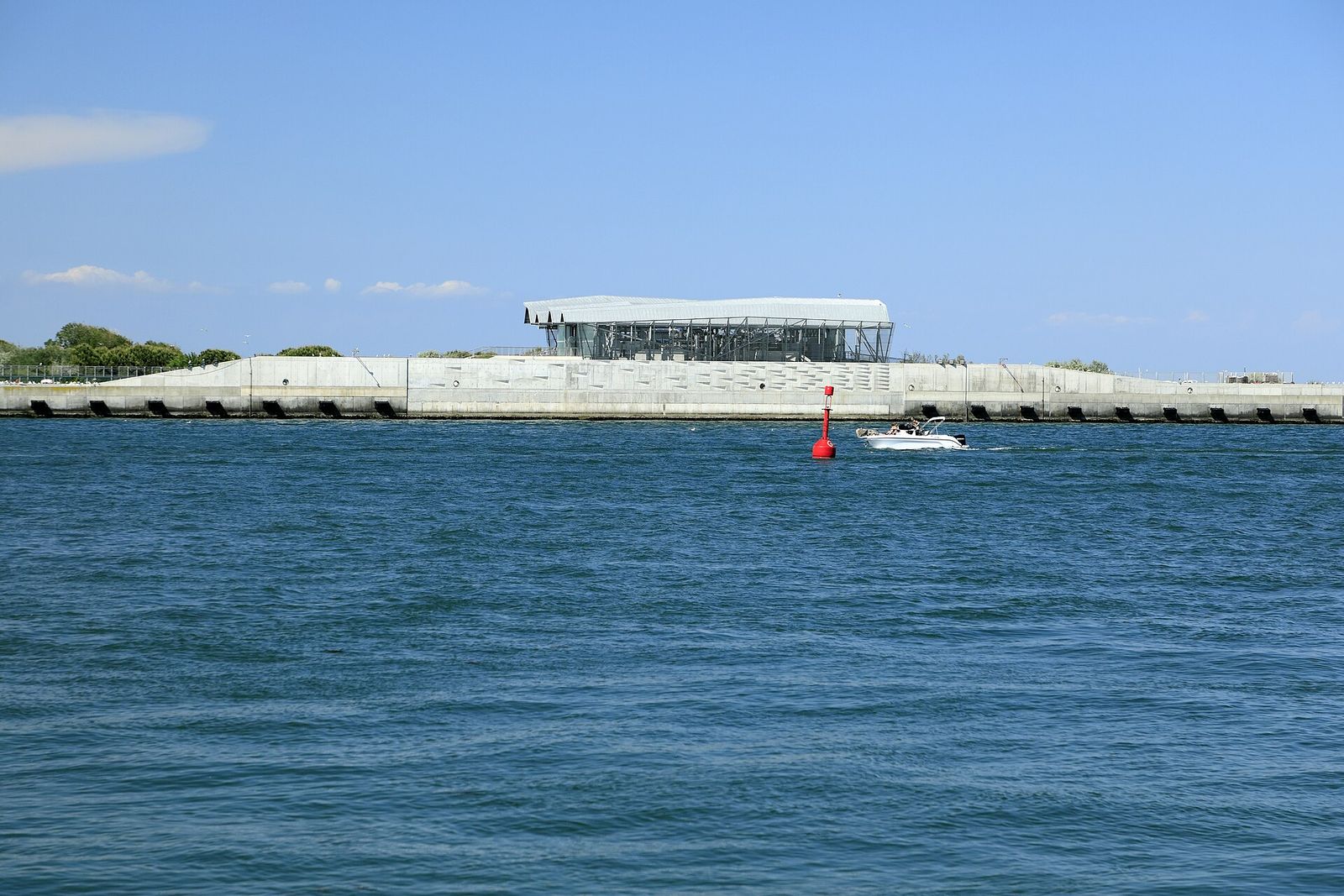
A large lock at Malamocco lets ships pass while the gates are up, and smaller locks at the Lido and Chioggia serve fishing boats, rescue craft and other small vessels.
The gates were first raised against a real high tide on 3 October 2020. The forecast at which they go up has been reported differently: 110 cm in the original operating rules, around 130 cm in practice in recent years. Tides below that level still reach the lowest parts of the city, so St Mark’s Square can flood while the gates stay down. In 2022 low glass barriers were put up around the basilica to keep such tides out of the church.
A contested defence
Few public works in Italy have been argued over for as long as MOSE. The idea took shape after the 1966 flood and the design in the 1980s, but construction began only in 2003, and deadline after deadline was missed. In 2014 a corruption investigation into the works led to more than thirty arrests and to the abolition of the Magistrato alle Acque, the state water authority whose name went back to the Republic.
The deeper arguments concern the lagoon itself. A lagoon lives on its exchange with the sea, and every closure cuts that exchange. Ecologists worry that as sea levels rise and closures become more frequent, the water will be renewed less often, with effects on oxygen, fish and marshes. The port worries about delays to shipping, and engineers about how well the hinges will resist salt and marine growth if closures become frequent. Supporters reply that without the gates the floods of recent autumns would have been far worse, and that MOSE buys the city time to adapt.
For a visitor the practical result is simple: the most extreme floods are now rarer, but moderate acqua alta has not gone away.
If you are here during acqua alta
- Check the forecast the evening beforeThe tide centre’s forecast tells you whether to expect water the next day and at what time the peak will come.
- Let the peak passA high tide usually floods the streets for a couple of hours around its peak and then drains away. Plan a museum, a church or a long lunch for that window rather than wading.
- Wear proper boots, or stay on higher groundWaterproof boots that reach well above the ankle are what residents use. Thin plastic overboots are a stopgap at best.
- Keep moving on the walkwaysPasserelle are narrow and carry people in both directions. Keep right, do not stop in the middle for photographs, and give way to residents carrying shopping.
- Expect changes to the boatsAt very high tides some water-bus routes are diverted or suspended, because boats cannot pass under low bridges or berth at flooded stops. The public transport operator posts notices at the stops; the chapter on getting around by water explains the network.
- Travel lightWheeled suitcases and flooded streets do not mix. If you arrive during acqua alta, be ready to carry your luggage.
Questions visitors ask
Does acqua alta happen every day?
No. The tide rises twice a day, but acqua alta needs several factors to coincide, mostly between autumn and early spring. Even in that season many days pass without any flooding.
Are the MOSE gates raised for every high tide?
No. They go up only when the forecast passes the set threshold. Lower tides still reach the lowest parts of the city, including St Mark’s Square.
Is it safe to visit during acqua alta?
Ordinary high water is part of city life, and with boots and some patience it is mainly an inconvenience. Take care near the water’s edge, and during storms or exceptional tides follow the instructions of the city authorities.
Can you see the gates?
When they are down, no: only the buildings and embankments at the inlets are visible, for example from the water-bus routes to the Lido and Pellestrina. When they are raised, the tops of the gates show as a line of yellow boxes across the inlet.